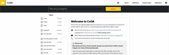
ABC CoDA, designing and building a digital archive to last a decade
How the Kablamo team designed and built a digital archive designed to process and handle over 6 PB of content and last longer than a decade.
Insights from the Kablamo Team.
How the Kablamo team designed and built a digital archive designed to process and handle over 6 PB of content and last longer than a decade.
AI Tools are the key to implementing successful agents, and with the rise of larger and larger parameterised models the implementation of new Agents is becoming simpler, faster and more accessible. What they're missing is the tools to actually do their job, so let's learn how to create one.

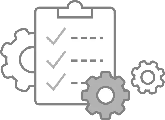
About automation of lambda layer deployment using CodePipeline

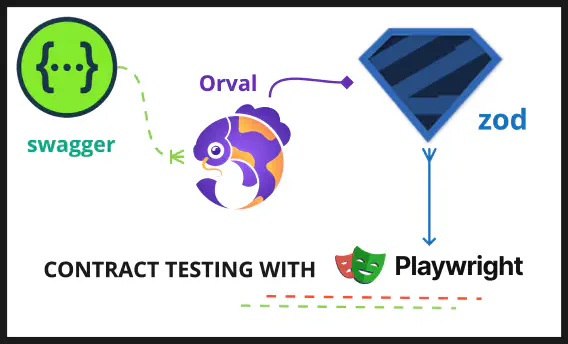
A reporting tool that integrates seamlessly with Playwright and CICD.

Insights from our Quality Engineering meetup held on 30th May 2024
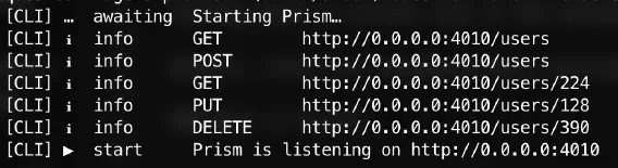
This will allow a producer of a microservice to be able to check the validity of the objects and types they are producing without having to rely on a mocking service.
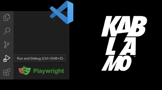
Debug your automation tests in 6 steps. With visual example of playwright using TypeScript in VSCode.
A glimpse into what it looks like to be front-end intern at Kablamo!

Learn How Appium works with simple examples and set-up code.

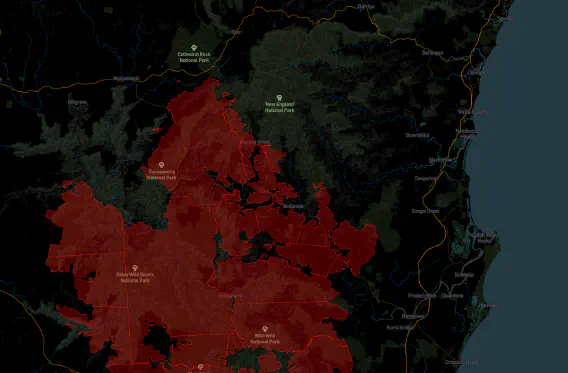
Spectral Indices are a set of mathematical equations performed on a per-pixel basis on data coming from multi-spectral remote sensing (satellite) data.
How to mock third-party services for integration testing of your own business logic. It's simple yet powerful.

Diving into React capabilities that make it truly amazing in modern web development.
Find out what the Kablamo Team uses on a day to day basis.

How to build a data quality monitoring job and its schedule using SageMaker and CDK
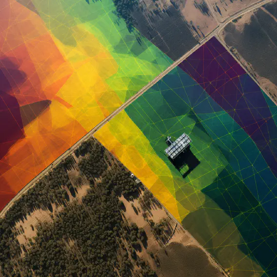
Harnessing Satellite Data for Land Health and Risk Assessment

The road to a successful and easily reproducible AWS infrastructure deployment is riddled with pitfalls and you do not want to introduce more of them by using an abstraction layer that brings even more pain and tears.
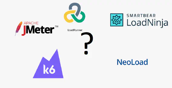
A quick analysis of the different performance test tools out on the market.
Set up and run API testing 🚀 rocket fast using latest version of nightwatchJS.
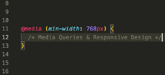
Learn all about media queries, responsive design principles and techniques, and the mobile-first approach we take at Kablamo.
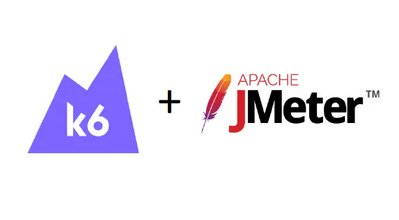
Convert your k6 performance test results from local machine into meaningful graphs for analysis.

My 4(ish) month software engineering internship journey @Kablamo Canada

How to disable bucket policy updates in Service Workbench, and integrate Lambda functions with DynamoDB Streams

The ways to improve Service Workbench observability, security and usability

AWS-built solutions like Service Workbench assume you'll be using SSH to connect. But there are better ways.
A more clean and meaningful way of writing automation test cases with ticket referencing

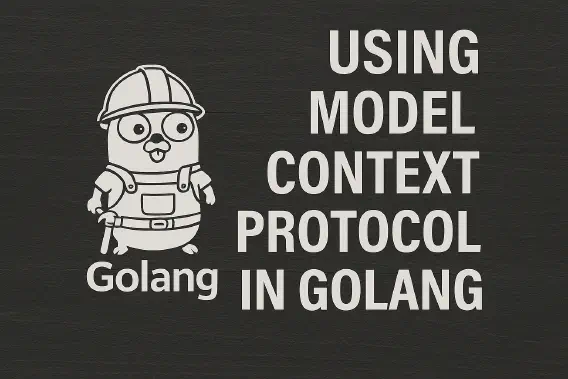
Using Go Generics, struct tags and reflection to implement a generic solution to a data encryption problem

A few years ago I had the experience of having a login page with two-factor auth for a client. We had to get creative.

Find out what the Kablamo Team uses on a day to day basis.

Find out what the Kablamo Team uses on a day to day basis.

Find out what the Kablamo Team uses on a day to day basis.
Find out what the Kablamo Team uses on a day to day basis.

Find out what the Kablamo Team uses on a day to day basis.

Find out what the Kablamo Team uses on a day to day basis.

Find out what the Kablamo Team uses on a day to day basis.

Find out what the Kablamo Team uses on a day to day basis.

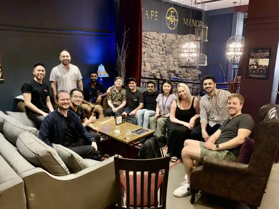
Why the retrospective is a powerful tool for relationship building

Find out what the Kablamo Team uses on a day to day basis.

Find out what the Kablamo Team uses on a day to day basis.

Find out what the Kablamo Team uses on a day to day basis.

Go file walk implementations have radically different performance characteristics. In 2021 the native implementation has improved so much, you don't need anything else.

Memcached and Redis. More different than first appearances would suggest. From how they use memory to how they expire items, the differences are not as subtle as you would expect.

I have learnt much from experiencing the workflows and practices at Kablamo. Let me tell you about my insights after seeing firsthand how great an impact it can have on productivity.
Recurring revenue is considered the holy grail for any technology business with SaaS being the main way to achieve this. In 2021 while more people are using the internet than ever, building your SaaS it's harder than ever.
CSS can be hard to grasp when you're first learning it. Here are some things that tripped me up when I was getting started that I wish I knew earlier on.
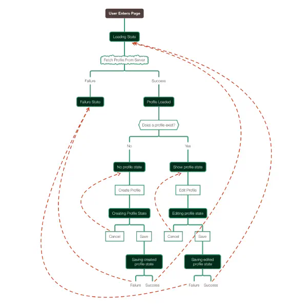
Application state in front-end clients is a complexity that is at best managed, and at worst the reason you can't deliver new features. What if you could know every state your app could be in and ensure that it can only be in those states?

This approach can be helpful when running AWS Glue in private VPC.

My 4-week software engineering summer internship journey @Kablamo
How to programmatically authenticate through Azure Active Directory in your Cypress tests in a manner that adheres to Cypress best practices and is also secure and consistent.
GeoJSON is an open format for geographical data and is used in a wide range of software products and libraries. Golang is a strictly typed language, which means that expressing the data model of GeoJSON can be challenging, because the data structure will change depending on what geometry type you want to represent.

Maps are not as straightforward as they appear. They are really an approximation which can sometimes be misleading because the Earth is not a perfect shape.

End to end UI tests are the bane of testers and developers alike. They are slow, brittle, and need constant updates. They are also indispensable. A good automation strategy will speed up the feedback loop between a defect being introduced and that defect being detected.

It might seem obvious but loading everything into memory is a bad idea. GoDoc examples, tutorials and Stack Overflow posts often use byte slices because its a quick way to illustrate a point but it is rarely the ideal data structure for engineered software solutions.

Are you still having an uphill battle with security, does it always feel like just one more problem to solve? Or you treat it more like a feature that gets de-prioritised at each of your Sprints? Perhaps you sometimes even struggle to understand what that "security hype" is all about? Read on and discover how to embrace security to make it the cornerstone of any information system you build.

This approach can be used to easily mock out any part of the code, including HTTP calls, database queries, and more. There is also an added advantage of making the code more modular and maintainable. Try this out on your own codebase and see how much more of your code you can test!

Ever wanted to build a quick Internet-of-Things device? This is a quick tutorial of how to get a Raspberry Pi up and running as a simple doorbell that responds to simple Slack commands.

At AWS re:Invent 2019, Amazon Detective was announced as a service to investigate and identify the root cause of potential security issues or suspicious activities. This week the service has become generally available.

Microservices or monolith? If you are still on the fence, this write-up might show you how to choose the right answer based on your project, team and their skills, budget and time constraints. As an added bonus, a look is also taken at the nanoservices: a fairly new phenomenon on the systems architecture landscape.
AWS CloudFormation now allows you to create your own custom resource types with the new Resource Provider Toolkit. This post walks you through the new toolkit's features and how to create your own custom resource type.

An example of how to use the export_test.go idiom to unit test a package wrapping AWS Athena.

Being a knowledge worker in a reasonably modern company affords you some privileges not every worker has — like working from home.

Developing reliable integration tests requires you to control every part of your execution environment, from the operating system up to the source code itself.
Amazon Textract was announced as a next-generation OCR service which not only performs word-based translation, but can also provide form and table value extractions.

A quick, no nonsense guide to getting started with Go Modules. I’m a fan of quick guides – just tell me what to do so I can start using it now. I don’t need an essay on why I should be using it or painful detail on the tool’s inner workings.